шаговый трекер/ gps часы/ прослушка окружения машины
Stepper tracker / gps clock / wiretapping machine environment
будет интересно людям которые ходят с металлоискателем, (что бы не ходить по одному месту дважды)
It will be interesting to people who walk with a metal detector (that would not walk one place twice)
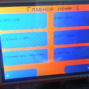
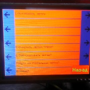
Про описание устройства, расскажу по пунктам меню:
1)GPS->USB
Можно подключить к компьютеру и использовать GPS приёмник устройства для работы в таких программах, как OziExplorer, SAS.Planet и других в качестве обычного GPS приёмника.
You can connect to a computer and use the GPS receiver device to work in programs such as OziExplorer, SAS.Planet and others as a normal GPS receiver.
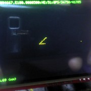
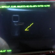
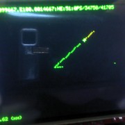
2)GPS->LCD
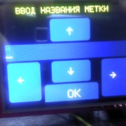
На экране выводится ваше текущее местоположение в качестве пикселя (экран 320х240 пикселей, по идее 1 пиксель это 1 метр Х 1 метр). Каждый ваш шаг записывается на карту памяти (Micro SD), при переходе на другой экран(предыдущий сохраняется). Есть возможность установить локальную метку на текущем экране, а так же глобальную метку текущего экрана(т.е. можно с любого экрана отслеживать направление и расстояние до сохранённой вами метки)
The screen displays your current location as a pixel (screen 320×240 pixels, in theory 1 pixel is 1 meter X 1 meter ). Each step is recorded on a memory card (Micro SD), when switching to another screen (the previous one is saved). It is possible to set a local label on the current screen, as well as the global label of the current screen (ie, you can track the direction and distance from the saved label from any screen)
4)GPS->Часы (автомобильные)
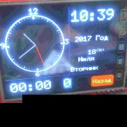
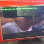
Выводят текущее время, дату, год, есть возможность установки будильника. Скрытая функция через меню настроек даёт возможность включать часы в момент включения устройства, т.е. маскироваться просто под ЧАСЫ, выход с них только по паролю. Так же позвонив на часы можно прослушивать окружение автомобиля, получить текущие GPS координаты автомобиля по SMS. Так же можно через настройки включить сохранение маршрута в GPX формате на карту.
Displays the current time, date, year, there is the possibility of setting an alarm. The hidden function through the settings menu allows you to turn the clock on when the device is turned on, i.e. mask just under the clock, exit with them only on the password. Just by calling the clock you can listen to the environment of the car, get the current GPS coordinates of the car via SMS. You can also use the settings to save the route in GPX format to the card.
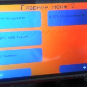
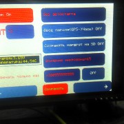
6)Настройки
Меню настроек. Можно установить GMT зону, звук нажатия на экране, ввод пароля при выходе с часов, чувствительность микрофона, на какой номер подымать трубку для прослушивания окружения, в какой пункт меню входить автоматически при включении устройства и другое. Все настройки сохраняются на micro SD карту.
Settings menu. You can set the GMT zone, the sound of pressing on the screen, entering the password when leaving the clock, the sensitivity of the microphone, which number to pick up the handset for listening to the environment, which menu item to enter automatically when the device is turned on, and more. All settings are saved to the micro SD card.
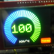
7)GPS->Спидометр
GPS спидометр от 0 до 100 километров в час.
GPS speedometer from 0 to 100 kilometers per hour.
8)GPS->Велокомпьютер
Велосипедный компьютер с одометром, графиком скорости, временем и другое.
Bicycle computer with odometer, speed schedule, time and more.
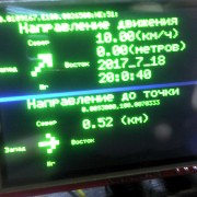
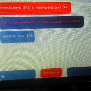
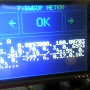
9)GPS->SMS
Есть возможность отсылать текущее местоположение с ссылкой на google maps в качестве SMS сообщения http://maps.google.com?q=22.2210132,10.2992521
А так же принимать сообщение с координатами GPS и отображать сразу же – (расстояние до точки и направление).
It is possible to send the current location with a link to google maps as an SMS message http://maps.google.com?q=22.2210132,10.2992521
And also receive a message with GPS coordinates and display immediately – (distance to the point and direction).
.
.
.
И многое другое, о чем я возможно забыл.
======================================================


видео http://dropmefiles.com/SDuR6
————————————————–
=====================================
I wanted to make a device for sale, but at the moment there is no time and money to collect everything in the corps and do it all, so I decided to put it in public. In clear weather and in a clean field, the device behaves more or less adequately, under other conditions the GPS receiver is probably needed better, the library used in the device also supports other GPS receivers.
————————————————– —
stlink flash dump connection – http://dropmefiles.com/RPD0a
—————————————————
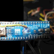
Детали:
1) 2.4 TFT touch LCD — протестировал на 0x9325 и S6D0154
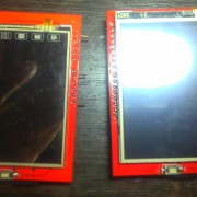

2) micro sd
3)TP4056
4) GSM SIM800L mini
5)GPS GY-NEO6MV2 NEO-6M или лучше, для большей точности.
6) maple mini STM32F103CBT6 частота 72мГц память программ 128кб

=====================================
Хотел сделать устройство для продажи, но в данный момент нет времени и денег это все собирать в корпус и этим всем заниматься, поэтому я решил выложить это в публичный доступ. При ясной погоде и в чистом поле, устройство ведёт себя более менее адекватно, при других условиях вероятно нужен GPS приёмник лучше, библиотека используемая в устройстве поддерживает и другие GPS приёмники.
—————————————————–
вы это делаете на свой страх и риск, я не знаю или это законно у вас в стране.
You do it at your own peril and risk, I do not know or it’s legal in your country.
normally i’d simply program this on an android phone as it needs gps + mobile (gsm/3g-wcdma/lte) etc
to do all that on stm32f103cb 20k sram with a gui is quite an achievement
[unknown_anonym – Thu Jul 20, 2017 1:06 pm] –
my english – not better what in google translator.
That’s no problem.
Just that it would be easier for the readers the get there the translated text in your post rather than open in another tab, and pasting the whole information there. Furthermore, the pictures would then not be referenced correctly according to the text.
So please change your post with the translated text. It should not be a problem for you, you know how to do it.
The United States government currently claims 4 meter RMS (7.8 meter 95% Confidence Interval) horizontal accuracy for civilian (SPS) GPS. Vertical accuracy is worse. Mind you, that’s the minimum. Some devices/locations reliably (95% of the time or better) can get 3 meter accuracy.10 Dec 2012
and then is theoretical resolution
https://gis.stackexchange.com/questions … acy-of-gps
and then it’s complicated by how many satellites are ‘visible’ as well
stephen
One meter seems too much especially without a good external antenna and without a wide sky.
Sub-meter receivers exists but they are not cheap.
all libs – http://file.sampo.ru/2vgf94/
http://radiokot.ru/forum/viewtopic.php? … 1#p3332601
https://www.hackster.io/rayburne/projects
I am certain your work would be most welcome.
Ray

